
Thank you for supporting this site ❤️
Make a donation
Make a donation
Gear up for your next adventure:
As an Amazon Associate, this site earns from qualifying purchases at no extra cost to you.
Yera topographic map
Click on the map to display elevation.
Thank you for supporting this site ❤️
Make a donation
Make a donation
Gear up for your next adventure:
As an Amazon Associate, this site earns from qualifying purchases at no extra cost to you.
About this map
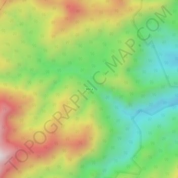
Name: Yera topographic map, elevation, terrain.
Location: Yera, Teorama, Occidente, Norte de Santander, Colombia (8.95409 -73.13577 8.99409 -73.09577)
Average elevation: 2,211 ft
Minimum elevation: 906 ft
Maximum elevation: 3,983 ft
Thank you for supporting this site ❤️
Make a donation
Make a donation
Gear up for your next adventure:
As an Amazon Associate, this site earns from qualifying purchases at no extra cost to you.