Geolocate

Sykehouse topographic map

Click on the map to display elevation.

Sykehouse

The village of Sykehouse contains the parish church of the Holy Trinity. Most of this grade II listed building was built in 1869 by C. H. Fowler, using red bricks and a Gothic Revival style. The tower is older, having been built in 1721, while the font is fifteenth century, but this is presumed to have come from elsewhere. Other listed buildings include a red-brick and rubble barn, attached to Marsh Hills Farmhouse, and the farmhouse itself, which is early eighteenth century with twentieth century alterations. Sykehouse also contains the Village Hall where numerous meetings are held; including: the Parish Council, Show Committee, Women's Institute, Cricket Club and the Parochial Church Council. The village is located at approximately 53° 38' 30" North, 1° 3' West, at an elevation of around 4 metres above sea level.

Wikipedia (CC-BY-SA 3.0)

About this map

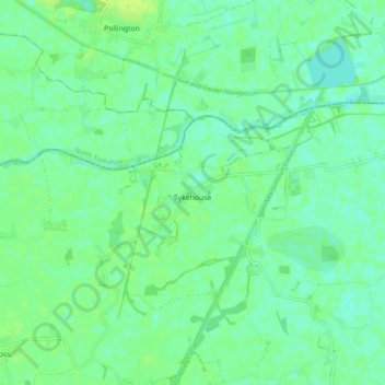
Name: Sykehouse topographic map, elevation, terrain.

Location: Sykehouse, Doncaster, South Yorkshire, England, United Kingdom (53.62932 -1.08150 53.66120 -0.98406)

Average elevation: 20 ft

Minimum elevation: 0 ft

Maximum elevation: 39 ft

Other topographic maps

Click on a map to view its topography, its elevation and its terrain.

Mexborough

United Kingdom > England > Doncaster

Average elevation: 154 ft

Edenthorpe

United Kingdom > England > Doncaster

Average elevation: 36 ft

Cantley Park

United Kingdom > England > Doncaster > Old Cantley

Average elevation: 39 ft

Conisbrough

United Kingdom > England > Doncaster

Average elevation: 200 ft

Arksey

United Kingdom > England > Doncaster

Average elevation: 26 ft

Harlington

United Kingdom > England > Doncaster

Average elevation: 135 ft

Clifton

United Kingdom > England > Doncaster

Average elevation: 305 ft

Cusworth

United Kingdom > England > Doncaster

Average elevation: 82 ft

Woodlands

United Kingdom > England > Doncaster

Average elevation: 98 ft

Old Denaby

United Kingdom > England > Doncaster

Average elevation: 125 ft

Carcroft

United Kingdom > England > Doncaster

Average elevation: 56 ft

Barnby Dun

United Kingdom > England > Doncaster

Average elevation: 26 ft

Sprotbrough

United Kingdom > England > Doncaster

Average elevation: 128 ft

Scawsby

United Kingdom > England > Doncaster

Average elevation: 82 ft

Tickhill Castle

United Kingdom > England > Doncaster > Tickhill

Average elevation: 69 ft

Hatfield Woodhouse

United Kingdom > England > Doncaster

Average elevation: 13 ft

Moorends

United Kingdom > England > Doncaster

Average elevation: 10 ft

Hatfield

United Kingdom > England > Doncaster

Average elevation: 20 ft

Skellow

United Kingdom > England > Doncaster

Average elevation: 98 ft

Adwick le Street

United Kingdom > England > Doncaster

Average elevation: 66 ft

Adwick le Street

United Kingdom > England > Doncaster

Average elevation: 66 ft

Sprotbrough

United Kingdom > England > Doncaster

Average elevation: 128 ft

New Rossington

United Kingdom > England > Doncaster

Average elevation: 39 ft

Conisbrough

United Kingdom > England > Doncaster

Average elevation: 200 ft

Gear up for your next adventure:

📱Heavy-Duty Phone Cases - Drop-proof and waterproof protection for outdoor navigation
🌎3D Topographic Globes - Raised relief globes for a tactile understanding of geography
🛏️Cold Weather Sleeping Bag - Warm sleeping bag for cold conditions
🛠️Outdoor Gear Repair Kit - Essential tools to fix gear on the trail
📱Solar Portable Charger - Solar power bank for charging devices off‑grid

As an Amazon Associate, this site earns from qualifying purchases at no extra cost to you.