Geolocate

Durlach topographic map

Click on the map to display elevation.

About this map

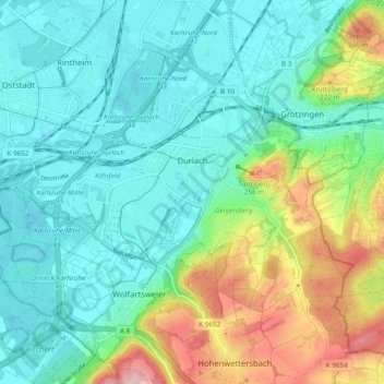
Name: Durlach topographic map, elevation, terrain.

Location: Durlach, Karlsruhe, Baden-Württemberg, 76227, Germany (48.96428 8.41479 49.02420 8.51045)

Average elevation: 518 ft

Minimum elevation: 351 ft

Maximum elevation: 968 ft

Gear up for your next adventure:

🧼Biodegradable Camping Soap - Eco‑friendly soap for outdoor hygiene
📱Heavy-Duty Phone Cases - Drop-proof and waterproof protection for outdoor navigation
🪶Camp Gear Gift Set - Perfect gift bundle for outdoor fans
🧥Waterproof Jacket for Hiking - Breathable and rugged rain jacket for outdoor excursions
🛰️Handheld GPS Units - Professional satellite navigators for precise backcountry mapping

As an Amazon Associate, this site earns from qualifying purchases at no extra cost to you.