
Santo António da Serra topographic map
Interactive map
Click on the map to display elevation.
About this map
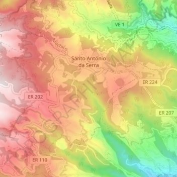
Name: Santo António da Serra topographic map, elevation, terrain.
Location: Santo António da Serra, Santa Cruz, Madère, Portugal (32.69782 -16.86552 32.73483 -16.80149)
Average elevation: 1,919 ft
Minimum elevation: 85 ft
Maximum elevation: 3,389 ft
Other topographic maps
Click on a map to view its topography, its elevation and its terrain.