

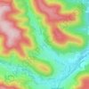
Horb am Neckar topographic map
Click on the map to display elevation.
About this map

Name: Horb am Neckar topographic map, elevation, terrain.
Average elevation: 1,752 ft
Minimum elevation: 1,201 ft
Maximum elevation: 2,352 ft
Other topographic maps
Click on a map to view its topography, its elevation and its terrain.

Mitteltal
Duitsland > Baden-Württemberg > Landkreis Freudenstadt > Baiersbronn
Average elevation: 2,339 ft

Schapbach
Duitsland > Baden-Württemberg > Landkreis Freudenstadt > Bad Rippoldsau-Schapbach
Average elevation: 1,847 ft

Zwickgabel
Duitsland > Baden-Württemberg > Landkreis Freudenstadt > Baiersbronn
Average elevation: 2,388 ft
Tonbach
Duitsland > Baden-Württemberg > Landkreis Freudenstadt > Baiersbronn
Average elevation: 2,215 ft

Kniebis
Duitsland > Baden-Württemberg > Landkreis Freudenstadt > Freudenstadt
Average elevation: 2,808 ft