Geolocate

Pasarraya topographic map

Click on the map to display elevation.

About this map

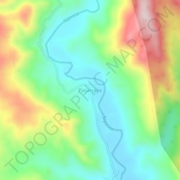
Name: Pasarraya topographic map, elevation, terrain.

Location: Pasarraya, Alto Saposoa, Huallaga, San Martín, Perú (-6.78504 -76.83399 -6.74504 -76.79399)

Average elevation: 1,713 ft

Minimum elevation: 1,230 ft

Maximum elevation: 2,562 ft

Gear up for your next adventure:

🔦Compact Flashlight - Reliable flashlight for emergencies
🏕️Tent Footprint - Protect your tent base from wear
🧥Men's Rain Shells - Premium waterproof and breathable jackets for mountain weather
🧭GPS Watch Accessories - Bands and chargers for GPS watches
🧺Microfiber Travel Towels - Compact and fast-drying towels for trail use

As an Amazon Associate, this site earns from qualifying purchases at no extra cost to you.