Geolocate

Staplehurst topographic map

Click on the map to display elevation.

About this map

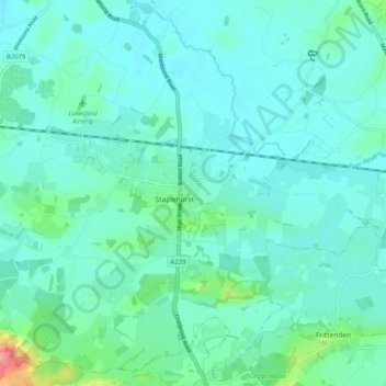
Name: Staplehurst topographic map, elevation, terrain.

Location: Staplehurst, Maidstone, Kent, England, United Kingdom (51.13395 0.49515 51.19335 0.59620)

Average elevation: 85 ft

Minimum elevation: 43 ft

Maximum elevation: 302 ft

Gear up for your next adventure:

🧯Portable Fire Pit - Compact fire pit for camping spots
🔌USB Car Charger - Car charger for on‑the‑go power needs
🪶Paracord Bracelet - Survival bracelet with built‑in tools
🧤Tactile Hiking Gloves - Keep hands warm while operating GPS and smartphone screens
🔭Stargazing Telescopes - Perfect for camping in low-light pollution areas shown on maps

As an Amazon Associate, this site earns from qualifying purchases at no extra cost to you.