
Make a donation
Gear up for your next adventure:
As an Amazon Associate, this site earns from qualifying purchases at no extra cost to you.
Huchting topographic map
Click on the map to display elevation.
Make a donation
Gear up for your next adventure:
As an Amazon Associate, this site earns from qualifying purchases at no extra cost to you.
Huchting
Der Name Huchting bezieht sich auf einen hochgelegenen Thingplatz (Gerichtsplatz auf dem „Hohen Thing“). Er könnte jedoch auch als Hucht-ing (-ing, -inghen, häufige althochdeutsche Endung für Heim, Heimstatt) auf eine hochgelegene Siedlung der Chauken hindeuten, die hier ab 300–200 v. Chr. auf der im Vergleich mit der kilometerbreiten Flussmarsch zwischen Weser und Ochtum höhergelegenen und damit weitgehend hochwasserfreien Vorgeest siedelten. Der Name wandelte sich von Huhtinge (1171), Huchtinge (1189) zu Huchtyghe (1259) und Huchthingehe (1362) und schließlich zu Huchting (1385).
Make a donation
Gear up for your next adventure:
As an Amazon Associate, this site earns from qualifying purchases at no extra cost to you.
About this map
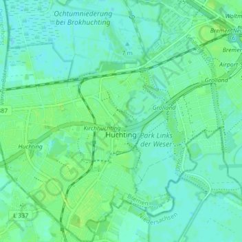
Name: Huchting topographic map, elevation, terrain.
Location: Huchting, Bremen-Süd, Bremen, 28259, Deutschland (53.03359 8.70682 53.07489 8.77056)
Average elevation: 16 ft
Minimum elevation: 3 ft
Maximum elevation: 33 ft
Make a donation
Gear up for your next adventure:
As an Amazon Associate, this site earns from qualifying purchases at no extra cost to you.
Other topographic maps
Click on a map to view its topography, its elevation and its terrain.
Make a donation
Gear up for your next adventure:
As an Amazon Associate, this site earns from qualifying purchases at no extra cost to you.