
Thank you for supporting this site ❤️
Make a donation
Make a donation
Gear up for your next adventure:
As an Amazon Associate, this site earns from qualifying purchases at no extra cost to you.
Muang Nong topographic map
Click on the map to display elevation.
Thank you for supporting this site ❤️
Make a donation
Make a donation
Gear up for your next adventure:
As an Amazon Associate, this site earns from qualifying purchases at no extra cost to you.
About this map
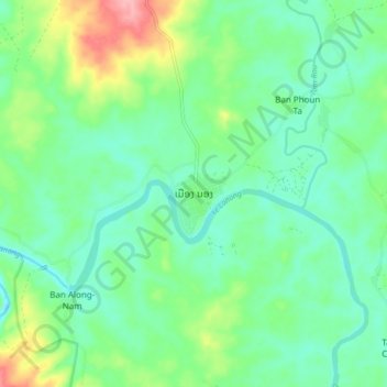
Name: Muang Nong topographic map, elevation, terrain.
Location: Muang Nong, Nong District, Savannakhet Province, Laos (16.33526 106.45829 16.41526 106.53829)
Average elevation: 912 ft
Minimum elevation: 801 ft
Maximum elevation: 1,191 ft
Thank you for supporting this site ❤️
Make a donation
Make a donation
Gear up for your next adventure:
As an Amazon Associate, this site earns from qualifying purchases at no extra cost to you.