
Thank you for supporting this site ❤️
Make a donation
Make a donation
Gear up for your next adventure:
As an Amazon Associate, this site earns from qualifying purchases at no extra cost to you.
Ponte della Pietra topographic map
Click on the map to display elevation.
Thank you for supporting this site ❤️
Make a donation
Make a donation
Gear up for your next adventure:
As an Amazon Associate, this site earns from qualifying purchases at no extra cost to you.
About this map
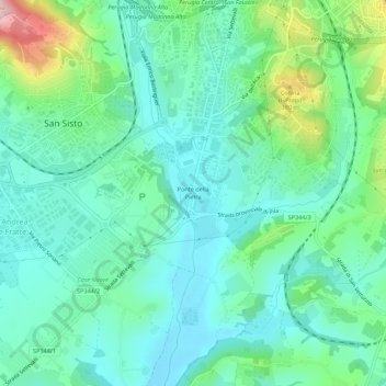
Name: Ponte della Pietra topographic map, elevation, terrain.
Location: Ponte della Pietra, Perugia, Umbria, 06156, Italia (43.05778 12.34481 43.09778 12.38481)
Average elevation: 932 ft
Minimum elevation: 745 ft
Maximum elevation: 1,529 ft
Thank you for supporting this site ❤️
Make a donation
Make a donation
Gear up for your next adventure:
As an Amazon Associate, this site earns from qualifying purchases at no extra cost to you.