Geolocate

Monte Bolettone topographic map

Click on the map to display elevation.

About this map

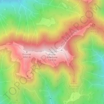
Name: Monte Bolettone topographic map, elevation, terrain.

Location: Monte Bolettone, Albavilla, Como, Lombardia, 22037, Italia (45.83710 9.17933 45.83720 9.17943)

Average elevation: 3,143 ft

Minimum elevation: 2,005 ft

Maximum elevation: 4,252 ft

Gear up for your next adventure:

🪶Wildlife Field Guides - Learn animal tracking and species ID
🪶Thermal Camp Blanket - Extra warmth for cold nights
🔋Rechargeable Batteries - Power up your outdoor devices
🧣Merino Neck Gaiters - Multi-functional headwear for wind and sun protection
📚Navigation Handbooks - Master the art of reading topographic maps and using a compass

As an Amazon Associate, this site earns from qualifying purchases at no extra cost to you.