
Thank you for supporting this site ❤️
Make a donation
Make a donation
Gear up for your next adventure:
As an Amazon Associate, this site earns from qualifying purchases at no extra cost to you.
Fey topographic map
Click on the map to display elevation.
Thank you for supporting this site ❤️
Make a donation
Make a donation
Gear up for your next adventure:
As an Amazon Associate, this site earns from qualifying purchases at no extra cost to you.
About this map
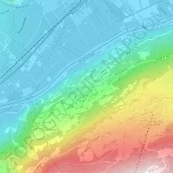
Name: Fey topographic map, elevation, terrain.
Location: Fey, Nendaz, Gundis, Wallis, 1997, Schweiz (46.16647 7.24905 46.20647 7.28905)
Average elevation: 3,002 ft
Minimum elevation: 1,529 ft
Maximum elevation: 6,506 ft
Thank you for supporting this site ❤️
Make a donation
Make a donation
Gear up for your next adventure:
As an Amazon Associate, this site earns from qualifying purchases at no extra cost to you.