
Thank you for supporting this site ❤️
Make a donation
Make a donation
Gear up for your next adventure:
As an Amazon Associate, this site earns from qualifying purchases at no extra cost to you.
Monkton topographic map
Click on the map to display elevation.
Thank you for supporting this site ❤️
Make a donation
Make a donation
Gear up for your next adventure:
As an Amazon Associate, this site earns from qualifying purchases at no extra cost to you.
About this map
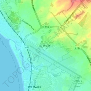
Name: Monkton topographic map, elevation, terrain.
Location: Monkton, South Ayrshire, Scotland, KA9 2RT, United Kingdom (55.49642 -4.62279 55.53642 -4.58279)
Average elevation: 66 ft
Minimum elevation: -3 ft
Maximum elevation: 256 ft
Thank you for supporting this site ❤️
Make a donation
Make a donation
Gear up for your next adventure:
As an Amazon Associate, this site earns from qualifying purchases at no extra cost to you.