Geolocate

Lalo topographic map

Click on the map to display elevation.

About this map

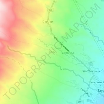
Name: Lalo topographic map, elevation, terrain.

Location: Lalo, Tayabas, Quezon, Calabarzon, 4327, Philippines (14.02113 121.55130 14.06113 121.59130)

Average elevation: 1,063 ft

Minimum elevation: 584 ft

Maximum elevation: 1,749 ft

Gear up for your next adventure:

💧Water Purification System - Clean water on the trail with reliable purifiers
🛠️Outdoor Gear Repair Kit - Essential tools to fix gear on the trail
🌡️Portable Weather Meter - Track weather conditions on the trail
🧭Compass with Lanyard - Easy‑carry compass for navigation
🗃️Trail First Aid Kit - Essential kit for outdoor injuries and emergencies

As an Amazon Associate, this site earns from qualifying purchases at no extra cost to you.