Geolocate

Aptos topographic map

Click on the map to display elevation.

About this map

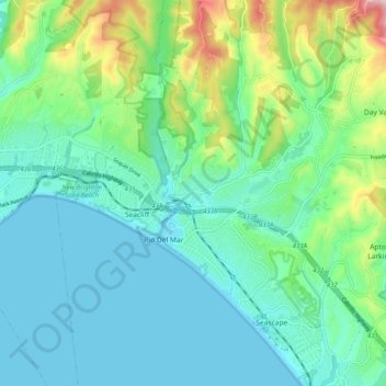
Name: Aptos topographic map, elevation, terrain.

Location: Aptos, Santa Cruz County, California, 95003, USA (36.93877 -121.93763 37.01877 -121.85763)

Average elevation: 249 ft

Minimum elevation: -3 ft

Maximum elevation: 1,099 ft

Gear up for your next adventure:

🛠️Backpacking Tool Kit - Essential toolkit for outdoor repairs
🧥Waterproof Jacket for Hiking - Breathable and rugged rain jacket for outdoor excursions
🔋Solar Power Banks - Keep your GPS and phone charged in remote wilderness areas
🖼️Topo Map Wall Art - Decorative topographic prints of famous peaks and regions
🔦LED Headlamp - Bright and durable LED headlamp for night navigation

As an Amazon Associate, this site earns from qualifying purchases at no extra cost to you.