Geolocate

Manchester topographic map

Click on the map to display elevation.

About this map

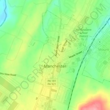
Name: Manchester topographic map, elevation, terrain.

Location: Manchester, York County, Pennsylvania, 17345, United States (40.05049 -76.72829 40.07260 -76.71090)

Average elevation: 449 ft

Minimum elevation: 299 ft

Maximum elevation: 650 ft

York County trails, hiking, mountain biking, running and outdoor activities

Gear up for your next adventure:

🛰️Handheld GPS Units - Professional satellite navigators for precise backcountry mapping
💧Water Purification System - Clean water on the trail with reliable purifiers
🎒Outdoor Daypacks - Lightweight backpacks designed for carrying maps and essential gear
🧭Outdoor Navigation Book - Learn advanced navigation skills
📶Satellite Messenger - Communication device off‑grid

As an Amazon Associate, this site earns from qualifying purchases at no extra cost to you.