
Thank you for supporting this site ❤️
Make a donation
Make a donation
Gear up for your next adventure:
As an Amazon Associate, this site earns from qualifying purchases at no extra cost to you.
Pichanaki topographic map
Click on the map to display elevation.
Thank you for supporting this site ❤️
Make a donation
Make a donation
Gear up for your next adventure:
As an Amazon Associate, this site earns from qualifying purchases at no extra cost to you.
About this map
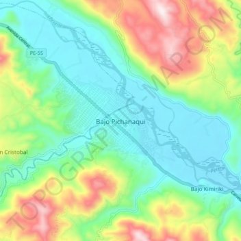
Name: Pichanaki topographic map, elevation, terrain.
Location: Pichanaki, Provincia de Chanchamayo, Junín, Perú (-10.94823 -74.89263 -10.90823 -74.85263)
Average elevation: 1,877 ft
Minimum elevation: 1,562 ft
Maximum elevation: 3,360 ft
Thank you for supporting this site ❤️
Make a donation
Make a donation
Gear up for your next adventure:
As an Amazon Associate, this site earns from qualifying purchases at no extra cost to you.