
Thank you for supporting this site ❤️
Make a donation
Make a donation
Gear up for your next adventure:
As an Amazon Associate, this site earns from qualifying purchases at no extra cost to you.
Cacet topographic map
Click on the map to display elevation.
Thank you for supporting this site ❤️
Make a donation
Make a donation
Gear up for your next adventure:
As an Amazon Associate, this site earns from qualifying purchases at no extra cost to you.
About this map
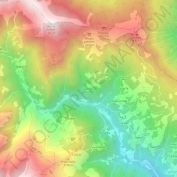
Name: Cacet topographic map, elevation, terrain.
Location: Cacet, Angrogna, Torino, Piemonte, 10066, Italia (44.84227 7.17718 44.88227 7.21718)
Average elevation: 3,799 ft
Minimum elevation: 1,995 ft
Maximum elevation: 5,715 ft
Thank you for supporting this site ❤️
Make a donation
Make a donation
Gear up for your next adventure:
As an Amazon Associate, this site earns from qualifying purchases at no extra cost to you.