Geolocate

Damascus topographic map

Click on the map to display elevation.

About this map

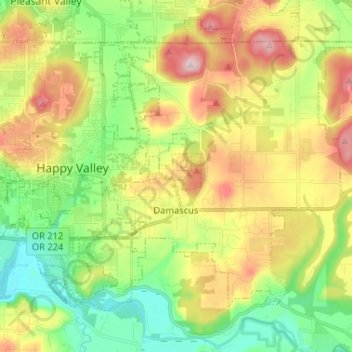
Name: Damascus topographic map, elevation, terrain.

Location: Damascus, Clackamas County, Oregon, 97089, United States (45.38259 -122.50770 45.46158 -122.39816)

Average elevation: 525 ft

Minimum elevation: 92 ft

Maximum elevation: 1,125 ft

Clackamas County trails, hiking, mountain biking, running and outdoor activities

Gear up for your next adventure:

😴Insulated Sleeping Pads - Compact and warm pads for high-elevation camping
🛰️Satellite Messengers - Emergency SOS and two-way messaging for off-grid adventures
🧯Portable Fire Pit - Compact fire pit for camping spots
📚USA Hiking Guide Books - Top trail guides and map books
🪶Trail Camera - Capture wildlife on your hikes

As an Amazon Associate, this site earns from qualifying purchases at no extra cost to you.