
Thank you for supporting this site ❤️
Make a donation
Make a donation
Gear up for your next adventure:
As an Amazon Associate, this site earns from qualifying purchases at no extra cost to you.
Neufisching topographic map
Click on the map to display elevation.
Thank you for supporting this site ❤️
Make a donation
Make a donation
Gear up for your next adventure:
As an Amazon Associate, this site earns from qualifying purchases at no extra cost to you.
About this map
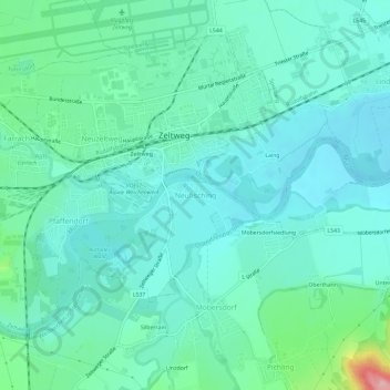
Name: Neufisching topographic map, elevation, terrain.
Location: Neufisching, Zeltweg, Bezirk Murtal, Styria, 8740, Austria (47.16503 14.73814 47.20503 14.77814)
Average elevation: 2,195 ft
Minimum elevation: 2,090 ft
Maximum elevation: 2,635 ft
Thank you for supporting this site ❤️
Make a donation
Make a donation
Gear up for your next adventure:
As an Amazon Associate, this site earns from qualifying purchases at no extra cost to you.