Geolocate

Vich topographic map

Click on the map to display elevation.

About this map

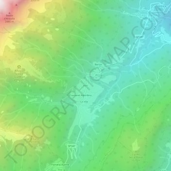
Name: Vich topographic map, elevation, terrain.

Location: Vich, Voltago Agordino, Belluno, Veneto, 32020, Italy (46.23545 11.96381 46.27545 12.00381)

Average elevation: 4,357 ft

Minimum elevation: 2,441 ft

Maximum elevation: 8,763 ft

Gear up for your next adventure:

🪓Survival Multi‑Tool - Versatile tool for camp and trail tasks
🛏️Cold Weather Sleeping Bag - Warm sleeping bag for cold conditions
🖼️Topo Map Wall Art - Decorative topographic prints of famous peaks and regions
🧭Orienteering Set - Complete compass and map reading kit
🧯Portable Fire Pit - Compact fire pit for camping spots

As an Amazon Associate, this site earns from qualifying purchases at no extra cost to you.