
Thank you for supporting this site ❤️
Make a donation
Make a donation
Gear up for your next adventure:
As an Amazon Associate, this site earns from qualifying purchases at no extra cost to you.
Tiahuanaco topographic map
Click on the map to display elevation.
Thank you for supporting this site ❤️
Make a donation
Make a donation
Gear up for your next adventure:
As an Amazon Associate, this site earns from qualifying purchases at no extra cost to you.
About this map
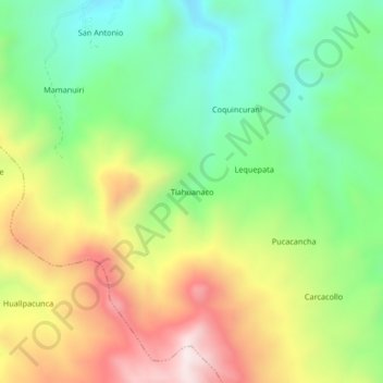
Name: Tiahuanaco topographic map, elevation, terrain.
Location: Tiahuanaco, Orurillo, Melgar, Puno, Perú (-14.78549 -70.54049 -14.74549 -70.50049)
Average elevation: 14,091 ft
Minimum elevation: 13,107 ft
Maximum elevation: 15,479 ft
Thank you for supporting this site ❤️
Make a donation
Make a donation
Gear up for your next adventure:
As an Amazon Associate, this site earns from qualifying purchases at no extra cost to you.