
Thank you for supporting this site ❤️
Make a donation
Make a donation
Gear up for your next adventure:
As an Amazon Associate, this site earns from qualifying purchases at no extra cost to you.
Labrador topographic map
Click on the map to display elevation.
Thank you for supporting this site ❤️
Make a donation
Make a donation
Gear up for your next adventure:
As an Amazon Associate, this site earns from qualifying purchases at no extra cost to you.
About this map
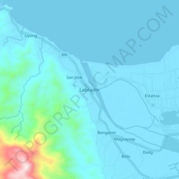
Name: Labrador topographic map, elevation, terrain.
Location: Labrador, Pangasinan, Ilocos Region, 2402, Philippines (15.98553 120.10534 16.06553 120.18534)
Average elevation: 240 ft
Minimum elevation: -7 ft
Maximum elevation: 2,493 ft
Thank you for supporting this site ❤️
Make a donation
Make a donation
Gear up for your next adventure:
As an Amazon Associate, this site earns from qualifying purchases at no extra cost to you.