Geolocate

Elberta topographic map

Click on the map to display elevation.

About this map

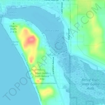
Name: Elberta topographic map, elevation, terrain.

Location: Elberta, Gilmore Township, Benzie County, Michigan, 49628, United States (44.61077 -86.24588 44.62926 -86.22035)

Average elevation: 614 ft

Minimum elevation: 571 ft

Maximum elevation: 843 ft

Benzie County trails, hiking, mountain biking, running and outdoor activities

Other topographic maps

Click on a map to view its topography, its elevation and its terrain.

Watervale

United States > Michigan > Benzie County

Average elevation: 627 ft

Nessen City

United States > Michigan > Benzie County

Average elevation: 906 ft

Bendon

United States > Michigan > Benzie County

Average elevation: 866 ft

Platte Lake

United States > Michigan > Benzie County

Platte Lake is located in Benzie County, which was molded into a land full of sand dunes by the glacial formations. Along with the sand dunes, the glaciers also left many lakes in the area, not only in Benzie but throughout the area. Platte Lake is located at an elevation of 584 feet (178 meters) above sea…

Average elevation: 607 ft

Crystal Mountain

United States > Michigan > Benzie County

Average elevation: 817 ft

Gear up for your next adventure:

🪶Thermal Camp Blanket - Extra warmth for cold nights
🕶️Glacier Sunglasses - Side shields to protect eyes from high-altitude snow glare
🚑Emergency Bivvies - Heat-reflective sleeping bags for survival situations
🧤Tactile Hiking Gloves - Keep hands warm while operating GPS and smartphone screens
🥾Women's Hiking Boots - Top-rated trail boots with ankle support and superior grip

As an Amazon Associate, this site earns from qualifying purchases at no extra cost to you.