
Kangos topographic map
Interactive map
Click on the map to display elevation.
About this map
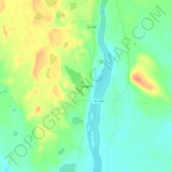
Name: Kangos topographic map, elevation, terrain.
Location: Kangos, Pajala kommun, Norrbottens län, Zweden (67.46453 22.63566 67.50453 22.67566)
Average elevation: 741 ft
Minimum elevation: 689 ft
Maximum elevation: 833 ft
Other topographic maps
Click on a map to view its topography, its elevation and its terrain.
Bodens kommun
Bodens kommun, Norrbottens län, Zweden
Average elevation: 407 ft
Haparanda kommun
Haparanda kommun, Norrbottens län, Zweden
Average elevation: 72 ft