Geolocate

Emerson topographic map

Click on the map to display elevation.

About this map

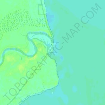
Name: Emerson topographic map, elevation, terrain.

Location: Emerson, Whitefish Township, Chippewa County, Michigan, United States (46.53641 -85.04925 46.57641 -85.00925)

Average elevation: 597 ft

Minimum elevation: 581 ft

Maximum elevation: 620 ft

Chippewa County trails, hiking, mountain biking, running and outdoor activities

Other topographic maps

Click on a map to view its topography, its elevation and its terrain.

Raber Township

United States > Michigan > Chippewa County

Average elevation: 646 ft

DeTour Village

United States > Michigan > Chippewa County

Average elevation: 597 ft

Dafter Township

United States > Michigan > Chippewa County

Average elevation: 676 ft

Detour Township

United States > Michigan > Chippewa County

Average elevation: 623 ft

Soo Township

United States > Michigan > Chippewa County

Average elevation: 656 ft

Sugar Island

United States > Michigan > Chippewa County

Average elevation: 636 ft

Lake Huron

United States > Michigan > Chippewa County

Average elevation: 600 ft

Gear up for your next adventure:

🔌Solar Panel Charger - Charge gear sustainably outdoors
🪶Wildlife Field Guides - Learn animal tracking and species ID
🔦LED Headlamp - Bright and durable LED headlamp for night navigation
🛰️Handheld GPS Units - Professional satellite navigators for precise backcountry mapping
🪓Survival Multi‑Tool - Versatile tool for camp and trail tasks

As an Amazon Associate, this site earns from qualifying purchases at no extra cost to you.