Geolocate

Ttula topographic map

Click on the map to display elevation.

About this map

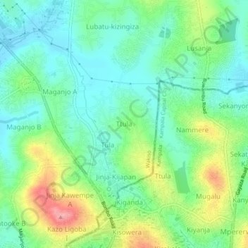
Name: Ttula topographic map, elevation, terrain.

Location: Ttula, Wakiso, Central Region, Uganda (0.37557 32.53914 0.41557 32.57914)

Average elevation: 3,898 ft

Minimum elevation: 3,780 ft

Maximum elevation: 4,147 ft

Gear up for your next adventure:

📱Solar Portable Charger - Solar power bank for charging devices off‑grid
🥾Men's Hiking Boots - Durable, waterproof footwear for rugged terrain and steep inclines
🔊Portable Camp Speaker - Music and alerts at camp
🛰️Handheld GPS Units - Professional satellite navigators for precise backcountry mapping
💧Water Purification System - Clean water on the trail with reliable purifiers

As an Amazon Associate, this site earns from qualifying purchases at no extra cost to you.