Geolocate

Calatayud topographic map

Click on the map to display elevation.

About this map
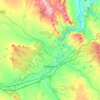
Name: Calatayud topographic map, elevation, terrain.

Location: Calatayud, Comunidad de Calatayud, Zaragoza, Aragon, 50300, Spain (41.30788 -1.74236 41.45831 -1.49463)

Average elevation: 2,274 ft

Minimum elevation: 1,378 ft

Maximum elevation: 4,124 ft

Other topographic maps

Click on a map to view its topography, its elevation and its terrain.

Pico Agudo

Spain > Aragon > Comunidad de Calatayud > Codos

Average elevation: 3,159 ft

Solana

Spain > Aragon > Comunidad de Calatayud > Calatayud

Average elevation: 2,867 ft

Valderoy

Spain > Aragon > Comunidad de Calatayud > Ateca

Average elevation: 2,162 ft

Gear up for your next adventure:

🔭Stargazing Telescopes - Perfect for camping in low-light pollution areas shown on maps
🧼Biodegradable Camping Soap - Eco‑friendly soap for outdoor hygiene
🥾Hiking Shoes - Durable and comfortable shoes for trail hiking
🪄Magnetic Compass - Accurate compass for navigation
📌Outdoor GPS Map App - Apps and devices for digital topographic navigation

As an Amazon Associate, this site earns from qualifying purchases at no extra cost to you.