Geolocate

Colle Aprico topographic map

Click on the map to display elevation.

About this map

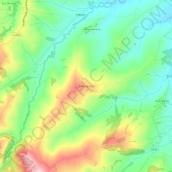
Name: Colle Aprico topographic map, elevation, terrain.

Location: Colle Aprico, Arcevia, Ancona, Marche, 60011, Italy (43.49116 12.96555 43.53116 13.00555)

Average elevation: 833 ft

Minimum elevation: 502 ft

Maximum elevation: 1,385 ft

Gear up for your next adventure:

🧣Merino Neck Gaiters - Multi-functional headwear for wind and sun protection
🔭Telescopic Hiking Pole - Adjustable pole for hiking stability
🔌Solar Panel Charger - Charge gear sustainably outdoors
📦Gear Storage Bags - Organize and protect outdoor equipment
🪶Camping Sleeping Pad - Comfortable sleeping pad for backpacking

As an Amazon Associate, this site earns from qualifying purchases at no extra cost to you.