Geolocate

Compo topographic map

Interactive map

Click on the map to display elevation.

About this map

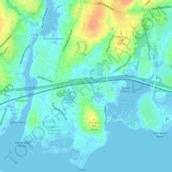
Name: Compo topographic map, elevation, terrain.

Location: Compo, Westport, Western Connecticut Planning Region, Connecticut, United States (41.10223 -73.36229 41.14044 -73.33987)

Average elevation: 33 ft

Minimum elevation: -26 ft

Maximum elevation: 148 ft

Other topographic maps

Click on a map to view its topography, its elevation and its terrain.

Greens Farms

United States > Connecticut > Western Connecticut Planning Region > Westport

Greens Farms, Westport, Western Connecticut Planning Region, Connecticut, United States

Average elevation: 33 ft