Geolocate

Bakersfield topographic map

Interactive map

Click on the map to display elevation.

About this map

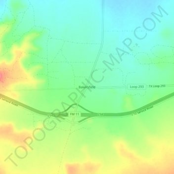
Name: Bakersfield topographic map, elevation, terrain.

Location: Bakersfield, Pecos County, Texas, United States (30.87127 -102.31791 30.91127 -102.27791)

Average elevation: 2,552 ft

Minimum elevation: 2,464 ft

Maximum elevation: 2,700 ft

Other topographic maps

Click on a map to view its topography, its elevation and its terrain.

Belding

United States > Texas > Pecos County

Belding, Pecos County, Texas, United States

Average elevation: 3,215 ft

Girvin

United States > Texas > Pecos County

Girvin, Pecos County, Texas, United States

Average elevation: 2,329 ft

Iraan

United States > Texas > Pecos County

Iraan, Pecos County, Texas, 79744, United States

Average elevation: 2,244 ft

Coyanosa

United States > Texas > Pecos County

Coyanosa, Pecos County, Texas, 79730, United States

Average elevation: 2,612 ft

Imperial

United States > Texas > Pecos County

Imperial, Pecos County, Texas, 79743, United States

Average elevation: 2,395 ft

Fort Stockton

United States > Texas > Pecos County

Fort Stockton, Pecos County, Texas, 79735, United States

Average elevation: 2,986 ft