Geolocate

Okotoks topographic map

Click on the map to display elevation.

About this map

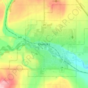
Name: Okotoks topographic map, elevation, terrain.

Location: Okotoks, Town of Okotoks, Alberta, T1S 2N7, Canada (50.68537 -114.01508 50.76537 -113.93508)

Average elevation: 3,596 ft

Minimum elevation: 3,366 ft

Maximum elevation: 3,967 ft

Gear up for your next adventure:

🗻Climbing Gear Basics - Essential gear for beginner climbers
❄️Traction Cleats - Prevent slips on icy trails during winter hikes
🧤Hiking Gloves - Protective gloves for rugged trails
🪶Compact Camp Shovel - Folding shovel for campsite tasks
📡GPS Antenna Upgrade - Enhance GPS reception in remote terrain

As an Amazon Associate, this site earns from qualifying purchases at no extra cost to you.