Geolocate

Kalagala topographic map

Click on the map to display elevation.

About this map

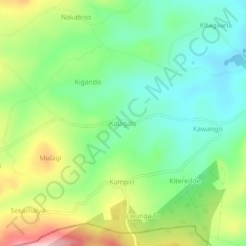
Name: Kalagala topographic map, elevation, terrain.

Location: Kalagala, Kyankwanzi, Central Region, Uganda (0.88515 31.70235 0.92515 31.74235)

Average elevation: 4,029 ft

Minimum elevation: 3,786 ft

Maximum elevation: 4,462 ft

Gear up for your next adventure:

🏕️Tent Footprint - Protect your tent base from wear
👓Polarized Sunglasses - Outdoor sunglasses for glare reduction
🛶Inflatable Kayak - Portable kayak for rivers, lakes, and expeditions
Solar GPS Watches - Advanced multisport watches with built-in topographic maps
Camping Coffee Makers - Enjoy premium coffee at the summit or campsite

As an Amazon Associate, this site earns from qualifying purchases at no extra cost to you.