
Make a donation
Gear up for your next adventure:
As an Amazon Associate, this site earns from qualifying purchases at no extra cost to you.
Pantabangan Dam topographic map
Click on the map to display elevation.
Make a donation
Gear up for your next adventure:
As an Amazon Associate, this site earns from qualifying purchases at no extra cost to you.
Pantabangan Dam
The dam is a 107 m (351 ft) tall and 1,615 m (5,299 ft) long embankment-type with 12,000,000 cu yd (9,174,658 m3) of homogeneous earth-fill and an impervious core. The crest of the dam is 12 m (39 ft) wide while the widest part of its base is 535 m (1,755 ft). The dam's crest sits at an elevation of 232 m (761 ft) and is composed of three sections: the main dam, a saddle dam, and an auxiliary dam located with the spillway. The spillway is a chute-type controlled by three radial gates but equipped with an overflow section as well. The design discharge of the spillway is 4,200 m3/s (148,322 cu ft/s). The dam's reservoir has a gross capacity of 2,996,000,000 m3 (2,428,897 acre⋅ft) and 2,083,000,000 m3 (1,688,716 acre⋅ft) of that volume is active (or useful) for irrigation and power. The dam sits at the head of a 853 km2 (329 sq mi) catchment area known as the Pantabangan–Carranglan Watershed Forest Reserve and its reservoir has a surface area of 69.62 km2 (27 sq mi) and elevation of 230 m (755 ft) when at its maximum level. The reservoir's life is estimated at 107 years due to silt from denudation. The dam was designed to withstand an intensity 8 earthquake.
Make a donation
Gear up for your next adventure:
As an Amazon Associate, this site earns from qualifying purchases at no extra cost to you.
About this map
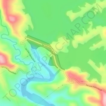
Name: Pantabangan Dam topographic map, elevation, terrain.
Average elevation: 689 ft
Minimum elevation: 423 ft
Maximum elevation: 1,066 ft
Make a donation
Gear up for your next adventure:
As an Amazon Associate, this site earns from qualifying purchases at no extra cost to you.