
Thank you for supporting this site ❤️
Make a donation
Make a donation
Gear up for your next adventure:
As an Amazon Associate, this site earns from qualifying purchases at no extra cost to you.
Pashpa topographic map
Click on the map to display elevation.
Thank you for supporting this site ❤️
Make a donation
Make a donation
Gear up for your next adventure:
As an Amazon Associate, this site earns from qualifying purchases at no extra cost to you.
About this map
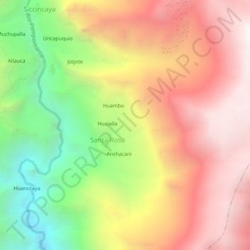
Name: Pashpa topographic map, elevation, terrain.
Location: Pashpa, Santa Rosa, Pampamarca, La Unión, Arequipa, Pérou (-15.14825 -72.89828 -15.10825 -72.85828)
Average elevation: 12,028 ft
Minimum elevation: 8,993 ft
Maximum elevation: 14,573 ft
Thank you for supporting this site ❤️
Make a donation
Make a donation
Gear up for your next adventure:
As an Amazon Associate, this site earns from qualifying purchases at no extra cost to you.