Geolocate

Cooran topographic map

Click on the map to display elevation.

About this map

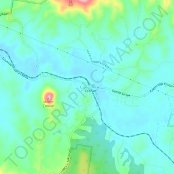
Name: Cooran topographic map, elevation, terrain.

Location: Cooran, Noosa Shire, Queensland, Australia (-26.35461 152.80212 -26.31461 152.84212)

Average elevation: 335 ft

Minimum elevation: 217 ft

Maximum elevation: 797 ft

Other topographic maps

Click on a map to view its topography, its elevation and its terrain.

Cooran

Australia > Queensland > Cooran

Average elevation: 413 ft

Gear up for your next adventure:

🧦Hiking Socks - Comfortable socks to prevent blisters on long hikes
📱Heavy-Duty Phone Cases - Drop-proof and waterproof protection for outdoor navigation
🧭Pro Hiking Compasses - High-accuracy liquid-filled compasses for topographic orientation
🪶Trail Camera - Capture wildlife on your hikes
😴Insulated Sleeping Pads - Compact and warm pads for high-elevation camping

As an Amazon Associate, this site earns from qualifying purchases at no extra cost to you.