Geolocate

Totnes topographic map

Click on the map to display elevation.

About this map

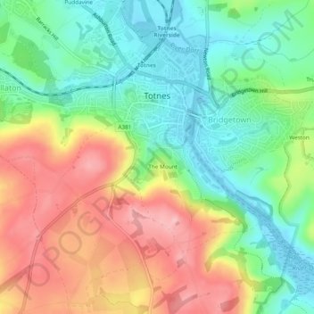
Name: Totnes topographic map, elevation, terrain.

Location: Totnes, South Hams, Devon, England, United Kingdom (50.41201 -3.71522 50.44066 -3.66777)

Average elevation: 217 ft

Minimum elevation: -13 ft

Maximum elevation: 512 ft

Other topographic maps

Click on a map to view its topography, its elevation and its terrain.

Penquit

United Kingdom > England > Devon > South Hams > Ermington

Average elevation: 217 ft

Weston

United Kingdom > England > Devon > South Hams > Berry Pomeroy

Average elevation: 194 ft

Gear up for your next adventure:

🗻Climbing Gear Basics - Essential gear for beginner climbers
Solar GPS Watches - Advanced multisport watches with built-in topographic maps
🦟Ultrasonic Repellers - Create a bug-free zone at your camp or rest stop
🎒Gear Packing Cubes - Organize your backpack efficiently
🦺Reflective Outdoor Gear - Safety gear for low‑light conditions

As an Amazon Associate, this site earns from qualifying purchases at no extra cost to you.