
Würgau topographic map
Click on the map to display elevation.
About this map
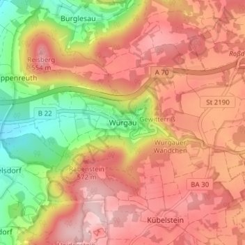
Name: Würgau topographic map, elevation, terrain.
Location: Würgau, Scheßlitz, Landkreis Bamberg, Bayern, Deutschland (49.95900 11.07038 49.99900 11.11038)
Average elevation: 1,549 ft
Minimum elevation: 1,063 ft
Maximum elevation: 1,886 ft
Other topographic maps
Click on a map to view its topography, its elevation and its terrain.