Geolocate

Tambo Lake topographic map

Click on the map to display elevation.

About this map

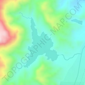
Name: Tambo Lake topographic map, elevation, terrain.

Location: Tambo Lake, Capas, Tarlac, Central Luzon, Philippines (15.28862 120.36700 15.30471 120.37962)

Average elevation: 958 ft

Minimum elevation: 614 ft

Maximum elevation: 1,742 ft

Other topographic maps

Click on a map to view its topography, its elevation and its terrain.

Aranguren

Philippines > Tarlac > Capas

Average elevation: 180 ft

San Nicolas

Philippines > Tarlac > Capas > Cubcub

Average elevation: 161 ft

Santa Lucia

Philippines > Tarlac > Capas

Average elevation: 361 ft

O'Donnell

Philippines > Tarlac > Capas

Average elevation: 420 ft

Lawy

Philippines > Tarlac > Capas

Average elevation: 220 ft

Gear up for your next adventure:

🔪Outdoor Multitools - Essential survival tools for gear repair and field use
🧺Microfiber Travel Towels - Compact and fast-drying towels for trail use
Backpacking Tents - Weight-optimized shelters for multi-day topographic surveys
🪄Magnetic Compass - Accurate compass for navigation
🎒Trail Energy Bars - High‑calorie bars for hiking energy

As an Amazon Associate, this site earns from qualifying purchases at no extra cost to you.