
Make a donation
Gear up for your next adventure:
As an Amazon Associate, this site earns from qualifying purchases at no extra cost to you.
Lachtal topographic map
Click on the map to display elevation.
Make a donation
Gear up for your next adventure:
As an Amazon Associate, this site earns from qualifying purchases at no extra cost to you.
About this map
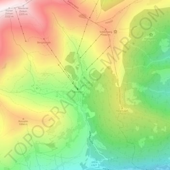
Name: Lachtal topographic map, elevation, terrain.
Location: Lachtal, Oberwölz, Bezirk Murau, Styria, 8831, Austria (47.23249 14.34824 47.27249 14.38824)
Average elevation: 5,587 ft
Minimum elevation: 4,104 ft
Maximum elevation: 7,260 ft
Make a donation
Gear up for your next adventure:
As an Amazon Associate, this site earns from qualifying purchases at no extra cost to you.
Other topographic maps
Click on a map to view its topography, its elevation and its terrain.
Sankt Peter am Kammersberg
Austria > Styria > Bezirk Murau > Sankt Peter am Kammersberg
Average elevation: 4,364 ft
Make a donation
Gear up for your next adventure:
As an Amazon Associate, this site earns from qualifying purchases at no extra cost to you.