
Le Mesnil-Amand topographic map
Interactive map
Click on the map to display elevation.
About this map
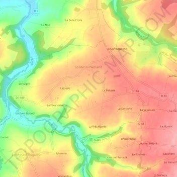
Name: Le Mesnil-Amand topographic map, elevation, terrain.
Average elevation: 308 ft
Minimum elevation: 79 ft
Maximum elevation: 466 ft
Other topographic maps
Click on a map to view its topography, its elevation and its terrain.
La Sayère
France > Normandie > Manche > Gavray-sur-Sienne > Sourdeval-les-Bois
Average elevation: 354 ft