Geolocate

Malabang topographic map

Click on the map to display elevation.

About this map

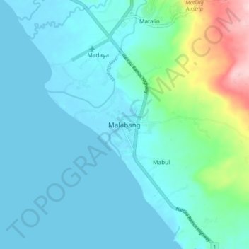
Name: Malabang topographic map, elevation, terrain.

Location: Malabang, Lanao del Sur, Bangsamoro, 9300, Philippines (7.55278 124.02863 7.63278 124.10863)

Average elevation: 121 ft

Minimum elevation: -3 ft

Maximum elevation: 761 ft

Other topographic maps

Click on a map to view its topography, its elevation and its terrain.

Kapatagan

Philippines > Lanao del Sur

Average elevation: 722 ft

Gear up for your next adventure:

🧤Hiking Gloves - Protective gloves for rugged trails
🔥Fast-Boil Camping Stoves - Efficient cooking systems for quick trail meals
🪶Fire Starter Kit - Reliable fire starter for survival and camping
🗻Climbing Gear Basics - Essential gear for beginner climbers
🪶LED Camping Lantern - Bright lantern for camp lighting

As an Amazon Associate, this site earns from qualifying purchases at no extra cost to you.