Geolocate

Ruwer topographic map

Click on the map to display elevation.

About this map

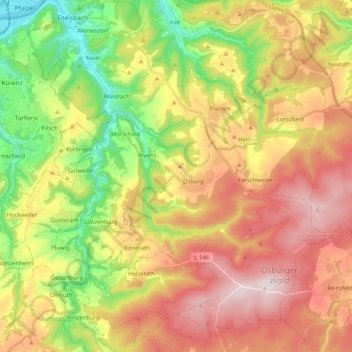
Name: Ruwer topographic map, elevation, terrain.

Location: Ruwer, Landkreis Trier-Saarburg, Rhineland-Palatinate, Germany (49.65077 6.68614 49.78325 6.87026)

Average elevation: 1,342 ft

Minimum elevation: 397 ft

Maximum elevation: 2,343 ft

Other topographic maps

Click on a map to view its topography, its elevation and its terrain.

Gear up for your next adventure:

🧯Portable Fire Pit - Compact fire pit for camping spots
🪶LED Camping Lantern - Bright lantern for camp lighting
🪶Camping Sleeping Pad - Comfortable sleeping pad for backpacking
🚁Photography Drones - Capture stunning aerial views of landforms and topography
🪑Portable Camp Table - Compact table for campsite meals

As an Amazon Associate, this site earns from qualifying purchases at no extra cost to you.