
Thank you for supporting this site ❤️
Make a donation
Make a donation
Gear up for your next adventure:
As an Amazon Associate, this site earns from qualifying purchases at no extra cost to you.
Lungmar topographic map
Click on the map to display elevation.
Thank you for supporting this site ❤️
Make a donation
Make a donation
Gear up for your next adventure:
As an Amazon Associate, this site earns from qualifying purchases at no extra cost to you.
About this map
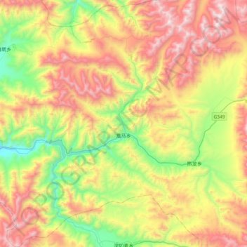
Name: Lungmar topographic map, elevation, terrain.
Location: Lungmar, Gyantse County, Shigatse Prefecture, Tibet, China (28.71236 89.76546 29.03474 90.03549)
Average elevation: 15,932 ft
Minimum elevation: 13,566 ft
Maximum elevation: 18,911 ft
Thank you for supporting this site ❤️
Make a donation
Make a donation
Gear up for your next adventure:
As an Amazon Associate, this site earns from qualifying purchases at no extra cost to you.