
Nutria topographic map
Interactive map
Click on the map to display elevation.
About this map
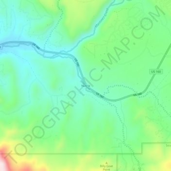
Name: Nutria topographic map, elevation, terrain.
Location: Nutria, Archuleta County, Colorado, 81147, United States (37.21084 -107.14560 37.25084 -107.10560)
Average elevation: 7,356 ft
Minimum elevation: 6,962 ft
Maximum elevation: 8,340 ft
Archuleta County trails, hiking, mountain biking, running and outdoor activities
Other topographic maps
Click on a map to view its topography, its elevation and its terrain.
Rio Grande, Pagosa, and Northern Railroad
United States > Colorado > Archuleta County
Average elevation: 7,408 ft