Geolocate

Donyatt topographic map

Click on the map to display elevation.

About this map

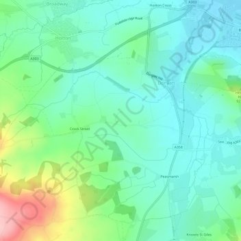
Name: Donyatt topographic map, elevation, terrain.

Location: Donyatt, Somerset, England, United Kingdom (50.90042 -2.97808 50.93182 -2.91939)

Average elevation: 243 ft

Minimum elevation: 98 ft

Maximum elevation: 650 ft

Gear up for your next adventure:

🔪Outdoor Multitools - Essential survival tools for gear repair and field use
🔋Rechargeable Batteries - Power up your outdoor devices
🧭Pro Hiking Compasses - High-accuracy liquid-filled compasses for topographic orientation
🧭Outdoor Navigation Book - Learn advanced navigation skills
🪑Ultralight Camp Chairs - Portable seating for resting after a long day of mapping

As an Amazon Associate, this site earns from qualifying purchases at no extra cost to you.