
Saterland - Seelterlound topographic map
Interactive map
Click on the map to display elevation.
About this map
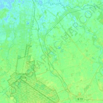
Name: Saterland - Seelterlound topographic map, elevation, terrain.
Average elevation: 16 ft
Minimum elevation: -7 ft
Maximum elevation: 46 ft
Other topographic maps
Click on a map to view its topography, its elevation and its terrain.
Friesoythe
Germany > Lower Saxony > Cloppenburg district
Friesoythe, Cloppenburg district, Lower Saxony, 26169, Germany
Average elevation: 43 ft
Saterland - Seelterlound
Germany > Lower Saxony > Cloppenburg district > Saterland - Seelterlound > Saterland - Seelterlound
Saterland - Seelterlound, Cloppenburg district, Lower Saxony, 26683, Germany
Average elevation: 20 ft