
Thank you for supporting this site ❤️
Make a donation
Make a donation
Gear up for your next adventure:
As an Amazon Associate, this site earns from qualifying purchases at no extra cost to you.
Atapaneo topographic map
Click on the map to display elevation.
Thank you for supporting this site ❤️
Make a donation
Make a donation
Gear up for your next adventure:
As an Amazon Associate, this site earns from qualifying purchases at no extra cost to you.
About this map
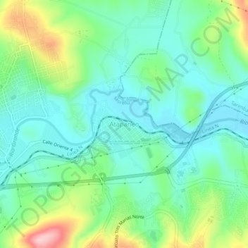
Name: Atapaneo topographic map, elevation, terrain.
Location: Atapaneo, Morelia, Michoacán, 58254, Mexico (19.71983 -101.13462 19.75983 -101.09462)
Average elevation: 6,309 ft
Minimum elevation: 6,129 ft
Maximum elevation: 6,765 ft
Thank you for supporting this site ❤️
Make a donation
Make a donation
Gear up for your next adventure:
As an Amazon Associate, this site earns from qualifying purchases at no extra cost to you.