
Thank you for supporting this site ❤️
Make a donation
Make a donation
Gear up for your next adventure:
As an Amazon Associate, this site earns from qualifying purchases at no extra cost to you.
Jardines topographic map
Click on the map to display elevation.
Thank you for supporting this site ❤️
Make a donation
Make a donation
Gear up for your next adventure:
As an Amazon Associate, this site earns from qualifying purchases at no extra cost to you.
About this map
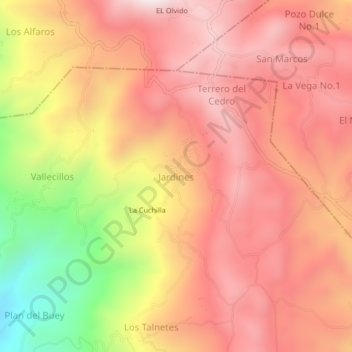
Name: Jardines topographic map, elevation, terrain.
Location: Jardines, San Jerónimo, Comayagua, Honduras (14.69585 -87.56456 14.73585 -87.52456)
Average elevation: 3,612 ft
Minimum elevation: 1,827 ft
Maximum elevation: 4,613 ft
Thank you for supporting this site ❤️
Make a donation
Make a donation
Gear up for your next adventure:
As an Amazon Associate, this site earns from qualifying purchases at no extra cost to you.