Geolocate

Raga topographic map

Click on the map to display elevation.

About this map

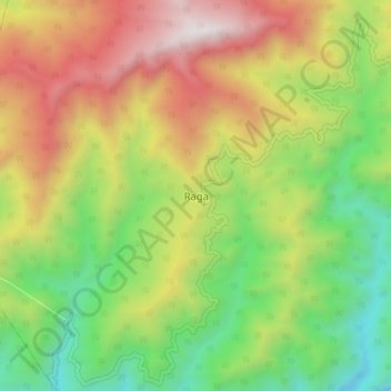
Name: Raga topographic map, elevation, terrain.

Location: Raga, Raga ADC, Kamle, Arunachal Pradesh, India (27.75683 94.02930 27.83683 94.10930)

Average elevation: 3,681 ft

Minimum elevation: 974 ft

Maximum elevation: 7,201 ft

Gear up for your next adventure:

🗺️Topographic Maps - Detailed topo maps for hiking, exploring and outdoor navigation
📱Solar Portable Charger - Solar power bank for charging devices off‑grid
🛠️Outdoor Gear Repair Kit - Essential tools to fix gear on the trail
🎒Hydration Pack - Hands‑free water reservoir for long hikes
🔦Compact Flashlight - Reliable flashlight for emergencies

As an Amazon Associate, this site earns from qualifying purchases at no extra cost to you.